





Planimetric Mapping and Survey Services
By capturing the intricate details of surface features, planimetric survey and mapping from LETEL provides insight for accurate planning and execution, minimizing risks and optimizing resources.
Planning for Flawless Execution
Our thorough analysis of flat surface characteristics through detailed planimetric mapping & surveys improves landscape understanding and visualizations, enhancing decision-making accuracy and efficiency and ensuring seamless project execution for outstanding results.
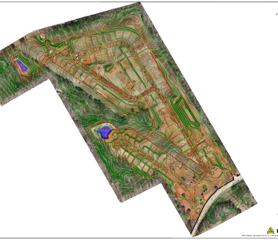
Letel provides professional planimetric survey and planimetric control survey solutions for civil engineers, contractors, and municipalities nationwide. Our planimetric mapping service captures above-ground features, including roads, structures, utilities, and drainage systems, with LiDAR-grade accuracy from our lidar mapping Georgia teams and beyond.

Advanced Data Capture
Our process involves detailed data capture of visible features using advanced technology, ensuring comprehensive landscape mapping. This approach accurately depicts all elements, facilitating precise modeling and analysis essential for project success.

Strategic Project Planning
Planimetric Mapping helps with strategic project planning, reduces unforeseen issues, allocates resources efficiently, and saves time. Our detailed maps make complex features easier to manage, leading to smarter decisions throughout the project lifecycle.

Efficient Risk Management
With LETEL’s accurate surface feature depiction, projects benefit from effective risk management, minimizing unexpected field conditions and disruptions. This accuracy is crucial for reliable cost estimation and risk mitigation, keeping projects aligned with budgets and timelines.
FAQs
What is a planimetric survey?
A planimetric survey captures the horizontal positions of visible surface features, such as roads, buildings, curbs, and utilities, without elevation data. As a trusted aerial lidar company, Letel uses aerial LiDAR and drone imagery to produce planimetric surveys that meet ASPRS accuracy standards for engineering and GIS applications.
What is a planimetric control survey and when do I need one?
A planimetric control survey establishes the ground-control framework that ties all mapped features to a certified coordinate system. It is required for transportation projects, municipal GIS databases, and construction permitting where spatial accuracy must be verified and documented.
How does your planimetric mapping service work?
Letel mobilizes drone, aerial LiDAR, or handheld LiDAR mapping over your project area, processes the point cloud into georeferenced imagery, and extracts planimetric features into CAD or GIS deliverables.Most projects receive final planimetric maps within 5 to 10 business days of flight completion.

Featured Projects
Explore our diverse range of featured projects, reflecting our proficiency in civil engineering, drone applications, and more across various sectors.
Blair’s Bridge
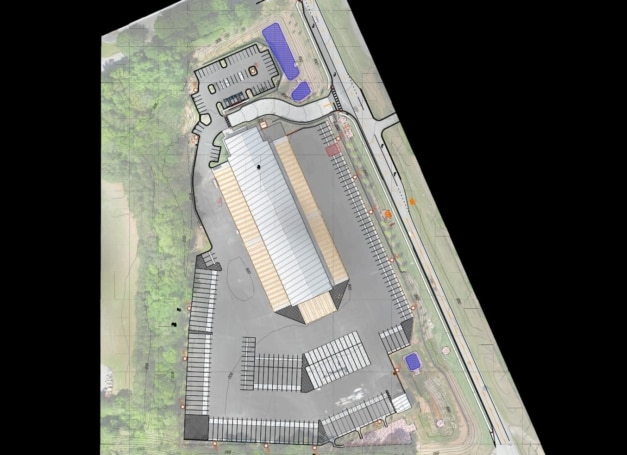
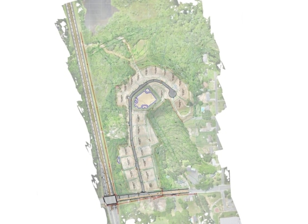
Planimetric Mapping for Blair’s Bridge Project Project Overview LETEL Metrics provided planimetric mapping services for the Blair’s Bridge project in Lithia Springs, Georgia. Across a 12-acre site, our team flew the property in 1.5 hours and delivered finished CAD-ready files within 8 hours of processing — giving the project team accurate, scaled site documentation in […]
West Sandtown
Planimetric mapping is two-dimensional representations of the Earth’s surface to show the location and spatial arrangement of features such as roads, building footprints, and bodies of water. This type of map simply depicts features horizontally and vertically and the accurate distances between them, by drawing lines around both man-made and natural features. These features are […]
Our Trusted Partners









LETEL is Ready When You Are
Click below to get started.