
All Projects
Blair’s Bridge
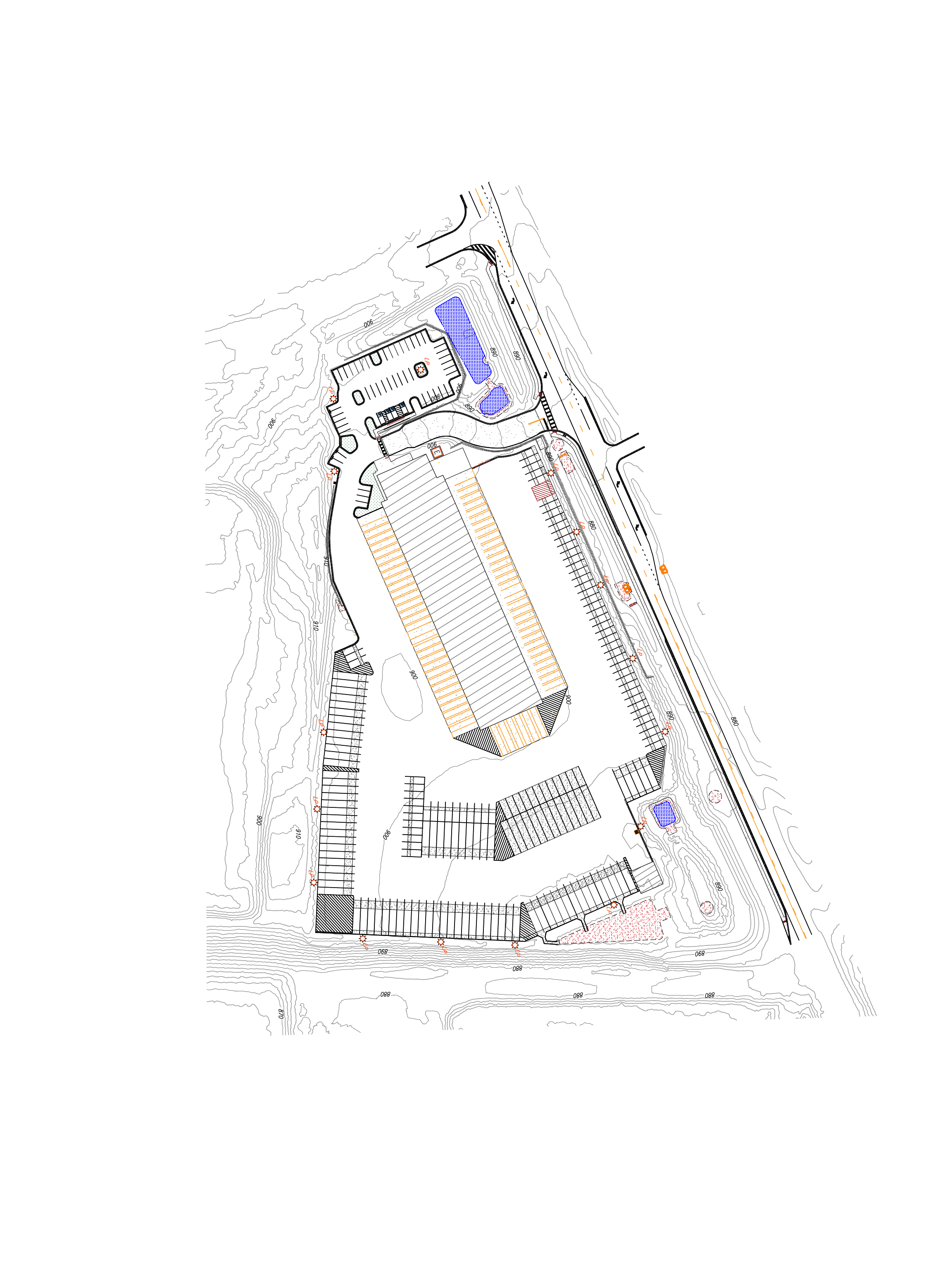
Planimetric Mapping for Blair’s Bridge Project
Project Overview
LETEL Metrics provided planimetric mapping services for the Blair’s Bridge project in Lithia Springs, Georgia. Across a 12-acre site, our team flew the property in 1.5 hours and delivered finished CAD-ready files within 8 hours of processing — giving the project team accurate, scaled site documentation in a fraction of the time required by conventional ground survey methods.
Project Snapshot
- Location: Lithia Springs, GA
- Service: Planimetric Mapping
- Site Size: 12 acres
- Flight Time: 1.5 hours
- CAD-to-Deliverable Time: 8 hours
- Deliverables: Linework-only file, linework with contours, linework with contours and orthomosaic
Planimetric Mapping for Blair’s Bridge Project
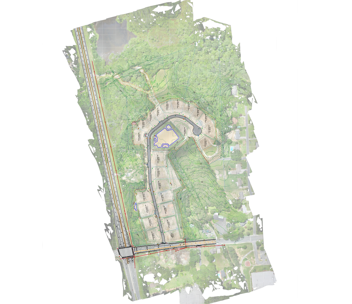
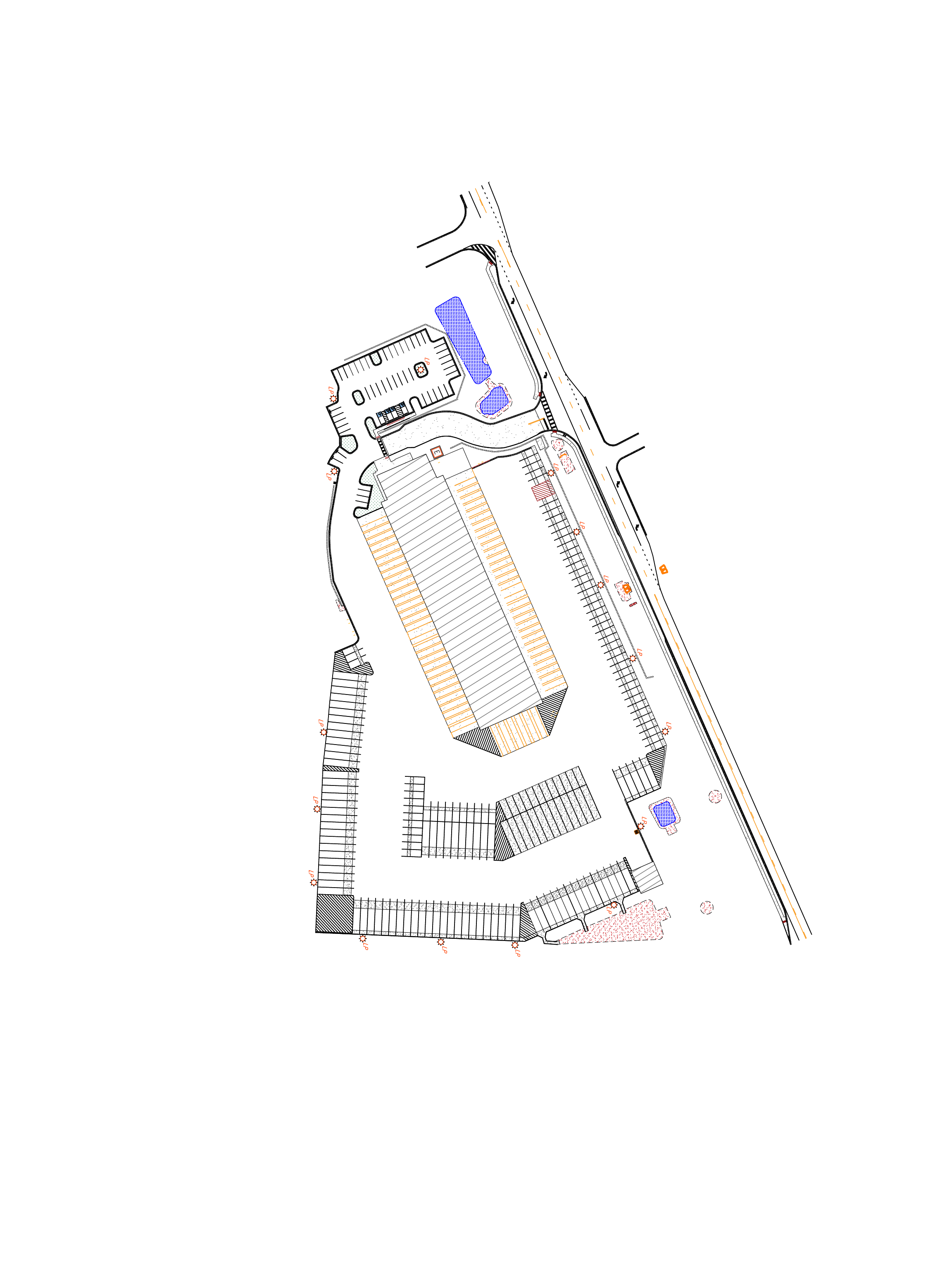
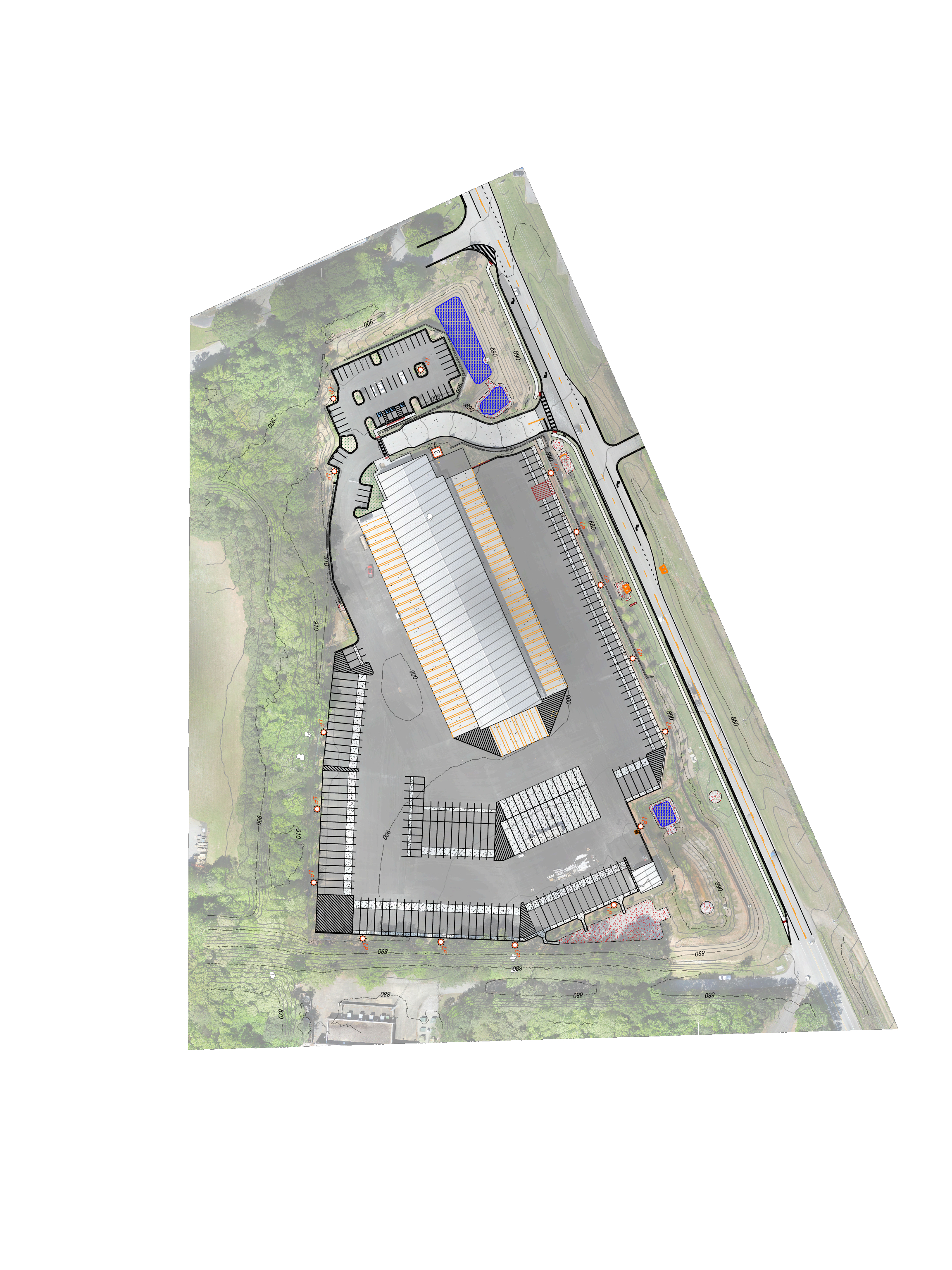
Planimetric mapping is two-dimensional representations of the Earth’s surface to show the location and spatial arrangement of features such as roads, building footprints, and bodies of water. This type of map simply depicts features horizontally and vertically and the accurate distances between them, by drawing lines around both man-made and natural features. These features are extracted from aerial photography and can be tailored to specific needs requested by the client. We also provide site topography that we obtain during our flight.
Three Layered Deliverables for Blair’s Bridge
For this project, our team captured the full 12-acre footprint in a single 1.5-hour flight, then produced three layered deliverables so the project team could choose the level of detail appropriate to each downstream task:
- Linework only — a clean vector file showing planimetric features without surface or imagery context, ideal for design overlays and construction staking references.
- Linework with contours — the same vector basemap combined with site topography generated from our flight data, supporting grading review, drainage analysis, and earthwork planning.
- Linework with contours and orthomosaic — the full visual context, pairing measurable linework and contours with a georeferenced aerial image of the site. This deliverable is especially useful for stakeholder presentations, permitting submittals, and construction progress reviews.
Why Aerial Capture Made Sense for This Site
A 12-acre site documented by traditional ground methods can take multiple days of field crew time, plus additional hours back in the office to draft the survey. By flying Blair’s Bridge with our drone platform, LETEL captured the entire site in 1.5 hours of airtime and turned around the finished CAD package in 8 hours of processing. Beyond the time savings, aerial capture also provides:
- Comprehensive coverage of areas that are difficult or unsafe to walk, including dense vegetation, steep slopes, and active work zones
- A permanent visual record of site conditions on the date of flight
- Higher feature density than a typical ground survey, so designers aren’t left guessing about what’s between shots
- Site topography included as part of the same flight, eliminating a separate mobilization
How LETEL Approaches Planimetric Projects
Every planimetric job at LETEL follows the same disciplined workflow: mission planning and airspace check, on-site flight with appropriate ground control, photogrammetric processing, feature extraction by a trained CAD technician, and a final QA pass before delivery. Feature sets are tailored to the client’s request — whether that means capturing only edge-of-pavement and building footprints, or extending to fence lines, utility structures, vegetation breaks, and drainage features. Deliverables are provided in the file format and coordinate system the client’s design team is already working in.
Need Planimetric Mapping for Your Site?
If you’re planning a development, infrastructure project, or site redesign and need accurate, CAD-ready documentation of existing conditions, LETEL can typically scope and schedule a flight within days. Call (404) 518-6985 or request a quote and tell us a little about your site — acreage, location, and the deliverables your design team needs.
12
Acres
8
Hours from CAD to Deliverable
1.5
Hours Flown