

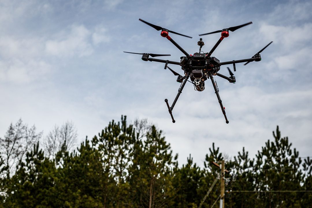
Aerial LiDAR
Enjoy cutting-edge precision in landscape analysis with our professional-grade Aerial LiDAR services.
Unveiling Landscapes of Opportunity
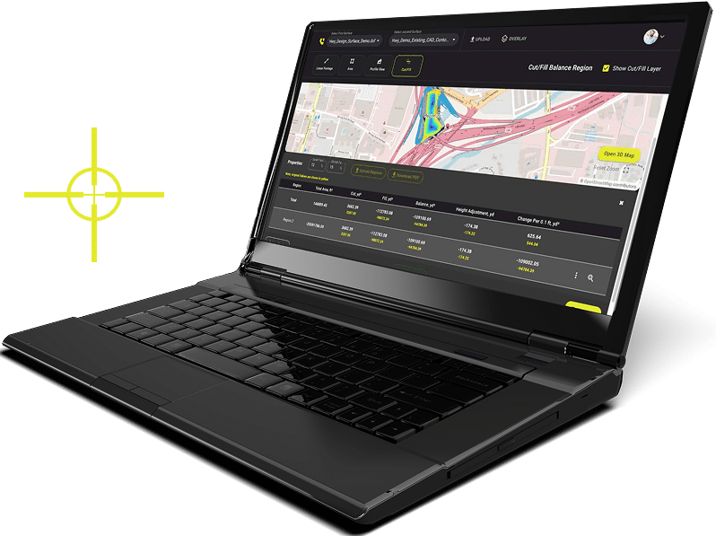
Through the lens of our Aerial LiDAR technology, we make landscapes not just visible but deeply insightful. At LETEL, Aerial LiDAR is not simply a service – it’s a key to clarity, enabling more informed decisions and precise actions for your business through the power of Aerial LiDAR mapping technology.
Unparalleled Precision in Data Capture
Harness highly precise data capture technology that ensures accuracy even in challenging terrains. Achieving an impressive accuracy within 1-3 centimeters, this technology offers the potential to significantly improve the quality and reliability of survey results, resulting in superior project outcomes.
Streamlined Resource Management
Benefit from the latest advancements in aerial mapping technology, which not only streamline project workflows but also help optimize resource allocation. Through reducing financial risk and leading to faster completion times, Aerial LiDAR from LETEL brings efficiency and economy to new heights in your engineering design projects.
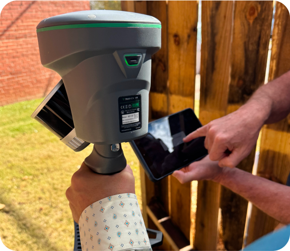
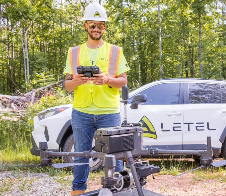
Enhanced Access with Handheld LiDAR
Our TrueView GO 116S handheld scanner allows us to capture high-precision 3D data in locations where drone deployment isn’t feasible. This service delivers 5cm accuracy in restricted airspace and challenging environments like dense urban areas or near secure facilities at the same professional grade you expect from our aerial solutions.

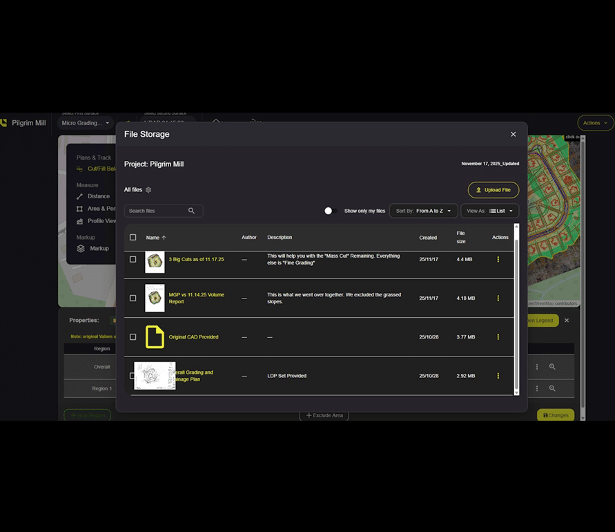
Featured Projects
Explore our diverse range of featured projects, reflecting our proficiency in civil engineering, drone applications, and more across various sectors.
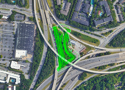
North Fork Pump Station
LETEL completed LiDAR services for Ruby-Collins Inc on this project known as North Fork Pump Station in Atlanta, GA.
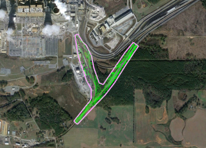
Bowen Rail Expansion
LETEL completed LiDAR services for Geocon Surveying, Inc. on this project known as Bowen Rail Expansion in Euharlee, GA.
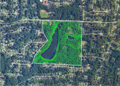
Lake Spivey
LETEL completed LiDAR services for Bowman on this project known as Lake Spivey in Stone Mountain, GA.
Our Trusted Partners


LETEL is Ready When You Are
Click below to get started.