

All Projects
Advenir Model
Full GPS localized Model for machine control
Project Overview
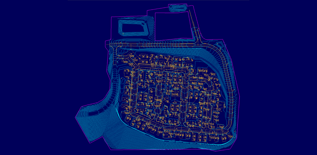
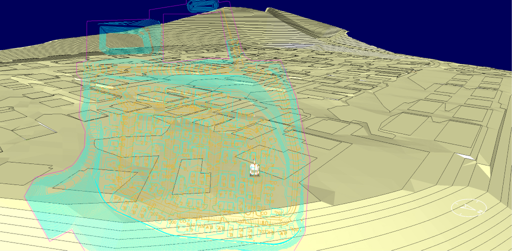
The Advenir Model project required a fully GPS-localized digital terrain model to drive machine control across a 36-acre development site in Cartersville, Georgia. Letel built the DTM directly from the civil engineer’s CAD design, localized it to the site’s on-the-ground GPS control, and delivered a production-ready file in 48 hours from CAD receipt.
Why GPS-Localized Machine Control Models Matter
A machine control model isn’t just a digital version of a paper plan. It’s the file that tells a GPS-equipped dozer or motor grader exactly where the blade should be at every point on the site. When the model is built right and localized correctly, it eliminates stake-and-shoot delays, reduces operator guesswork, and lets a single operator hit design grade on the first pass. When it’s built wrong — or delivered late — grading stops.
Sites like Advenir come with tight earthwork tolerances, complex pad layouts, and a sequencing schedule that doesn’t tolerate waiting on revised models. The contractor needed a DTM that matched the engineer’s design surface exactly, localized cleanly to the site’s GPS base and rover setup so machines could run automatic blade control from day one, and was delivered fast enough to keep grading on schedule.
Letel’s Approach
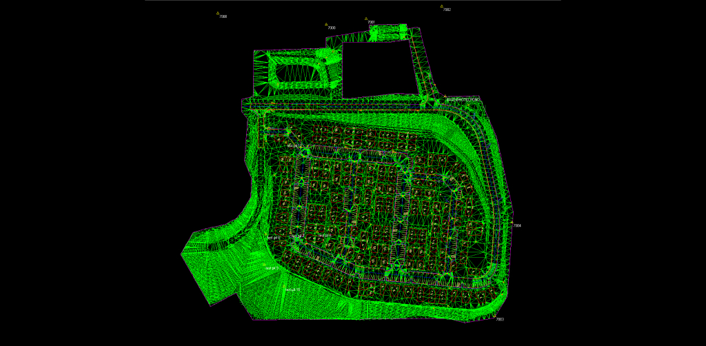
Letel’s DTM team rebuilt the design surface from the engineer’s CAD files, validated it against existing-conditions survey data, and localized the model to the site’s published control. Every breakline, pad elevation, and slope tie was checked against the design intent before export.
Because the deliverable was meant for machine control rather than office reference, particular attention went to the things that cause field problems: clean surface triangulation with no flat triangles or vertical faces, accurate transitions between pads and surrounding grade, correct localization parameters, and file formats matched to the major machine control platforms used in the field. The result is a model an operator can load and run, not a file that needs cleanup before it’s useful.
Project Stats
- 36 acres of fully modeled, machine-ready terrain
- 48 hours from CAD receipt to localized deliverable
- Model built for direct loading into GPS machine control systems
About the Project
Advenir is a development site in Cartersville, Georgia, in Bartow County. Letel’s DTM and GPS machine control modeling services produced a fully localized digital terrain model that the grading contractor could load directly into equipment and run from the first day on site. The Advenir Model is a representative example of how Letel’s DTM workflow keeps grading crews productive — turning the civil engineer’s design into a field-ready, GPS-localized model in days, not weeks.
36
Acres
48
Hours from CAD
Hours from CAD
to Deliverable
