

Indoor Digital Mapping
LETEL’s Indoor Digital Mapping service transforms complex interiors into precise, geospatially accurate digital floor plans—enhancing safety, compliance, and emergency readiness.
Built for Safety. Designed for Clarity.
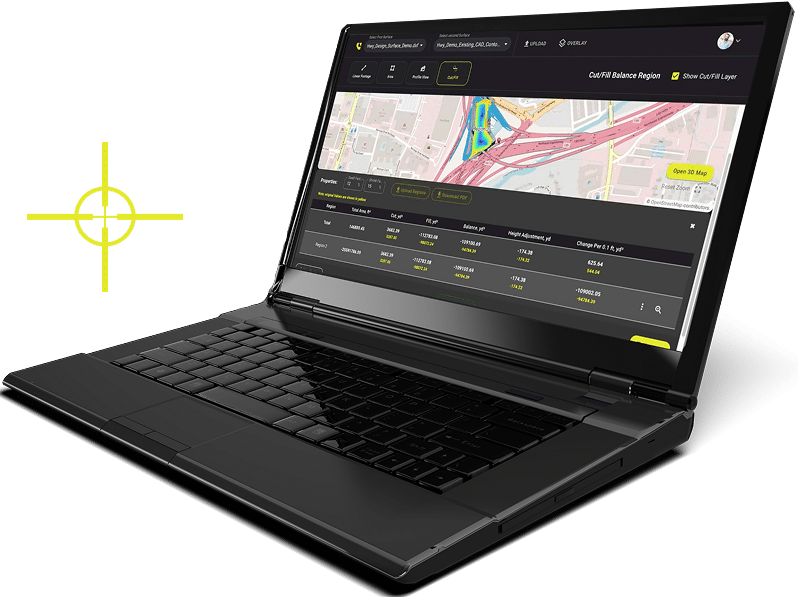
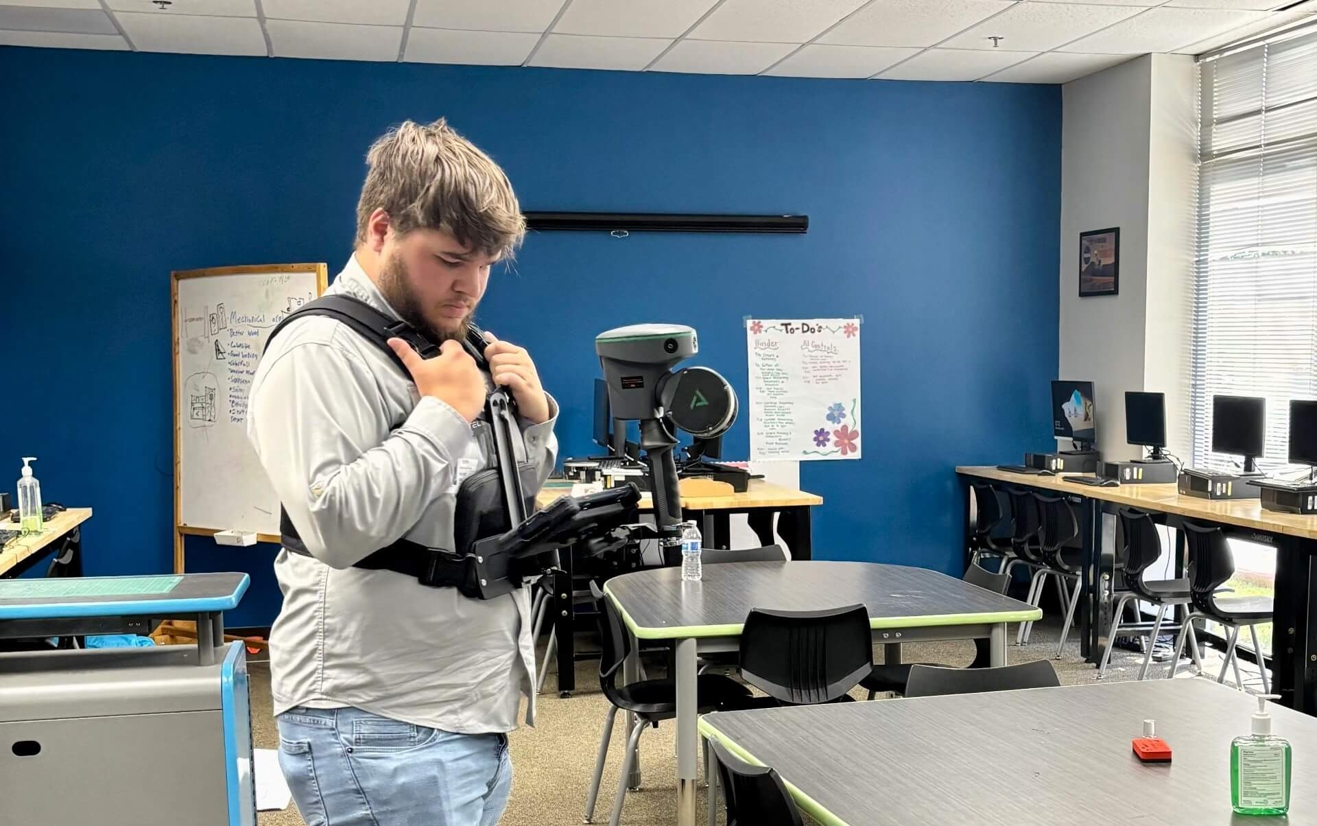
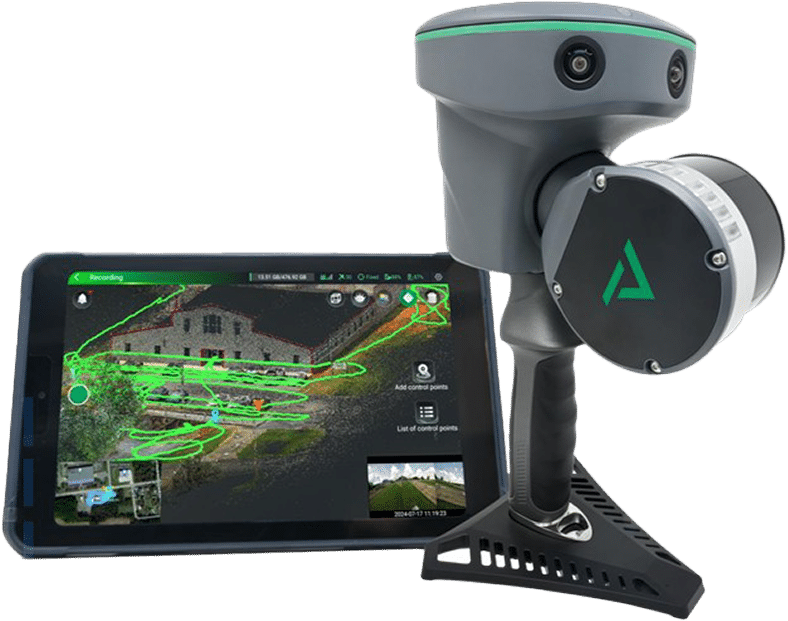
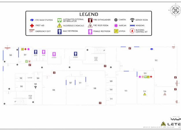
Using a combination of LiDAR, GPS, and building schematics, LETEL creates interactive digital maps that detail everything from room layouts to emergency assets. These maps are easily updated, compatible with public safety systems, and optimized to help first responders and facility teams navigate critical spaces with speed and confidence.
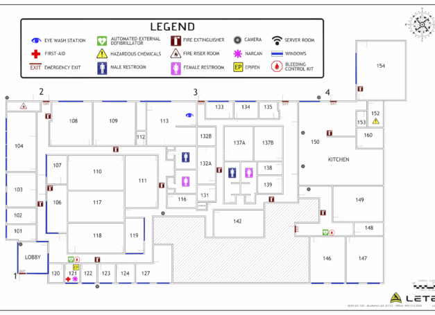
Down to the Details
Deep Industry Insight
At LETEL, our firsthand industry experience enables us to tailor dynamic solutions that align with your unique challenges.
Location Tagging
Identify and mark life-saving resources like fire alarms, AEDs, cameras, utility shutoffs, and access points.
Geospatial Accuracy
Our maps sync with GPS and GIS systems to ensure your digital view matches the real world—down to the centimeter.
Emergency System Integration
LETEL maps are compatible with public safety tools, panic alert systems, and 911 dispatch software for quicker, clearer response coordination.
Real-Time Updates
As your building changes, so can your map. Our platform supports continuous updates for renovations, security upgrades, and more.

Featured Projects
Explore our diverse range of featured projects, reflecting our proficiency in civil engineering, drone applications, and more across various sectors.
ResponsiveEd
LETEL provided Indoor Digital Mapping services for a Texas charter school organization in Dallas, TX.
Highschool
LETEL provided Indoor Digital Mapping services for the Georgia School District in West GA.

LETEL is Ready When You Are
Click below to get started.